Category Archives: ESRI

ArcMap: 1999 to 2024

We finally have an end date for ArcMap! This has been something that has been a long time coming, but I would say is certainly due now. ArcMap final date of support for software updates and patches has been announced as Feb 2024. ESRI launched ArcGIS Pro, the replacement for ArcMap, several years ago and people have been slowly transitioning.

ArcMap holds a special place in my heart because it is the software that I learnt GIS on. I first came across it in my undergraduate Geography degree at University of Leicester in 2003 – introduced to me by a certain Prof. Nick Tate if I remember correctly. This was the first time I had come across the combination of Geography and Computer Science and the subject suited me down to the ground.
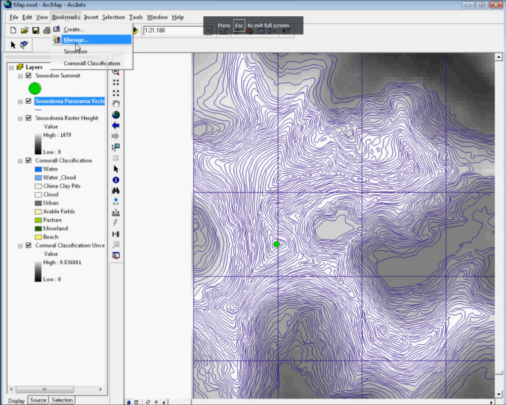
Later on, I also spent a lot of time working with ArcMap 9.2 (above), which I used in my programming skills to use VBA (Visual Basic Applications) code to create a map that made sounds – an area called sonification, which formed part of my early research interests.

Things have certainly changed in the 20+ years since 2003. ArcMap itself progressed from version 8.3 all the way up to the now retiring version 10.8.2. Of course we have also seen the rise of open source: QGIS in particular as a competitor to ArcMap, and now potentially better than ArcMap or ArcGIS Pro, depending exactly who you are and what you are trying to-do.

We’ve also seen the rise (again) of scripting. With R leading the way and Python a performing a quick catch-up, the combination of easier to use software and ease of access to the benefits of scripting has seen GIS become much more accessible than it was 20 years ago. Some colleagues who have been using GIS longer than I have remember the days of AML, ArcInfo and Sun Microsystems – all of which used command line interfaces to work with data. Much of this was to handle larger data sets than was easy to do in a graphical interface with limited computer resources – much the same situation we see now with big data and bigger computers – but still with limited computer power to process that data.

I was saddened to hear that some students are still being taught ArcMap:

From https://twitter.com/pokateo_maps/status/1747717333211373896


For anyone teaching GIS now, ArcMap is not the tool to teach. It has been a long hard road of transition from ArcMap and I know moving software is not easy, but if anyone is still teaching ArcMap, I very much hope this is its final year. Of course anyone who would like help transitioning, ESRI provide a range of very good materials and I also have good consultancy rates – just get in touch!

One constant challenge in the geospatial environment is that the tools and technologies constantly change – and we see this across the board of geospatial. My advice to anyone coming into this area is to at least keep up with the changes and have an idea of what is happening, even if you don’t use the cutting edge in your own work. Much of GIS’s power is in its versatility and you can get 80% of this benefit with only learning 20% of the tools! Also that 20% of knowledge will easily transfer between QGIS, ArcGIS Pro, online web maps and many other GIS.

I’m really looking forward to the next 20 years, and who knows what it will hold?!

Best of luck with your GIS work!
ESRI UK & GeoBusiness: GeoAI & Digital Twins

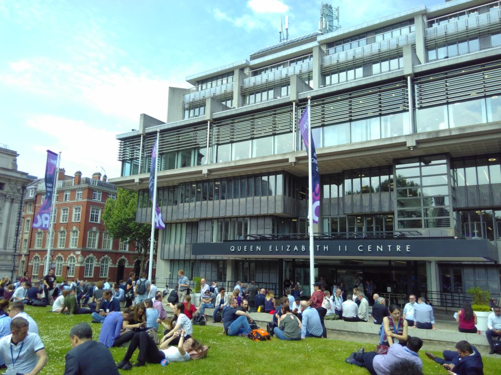
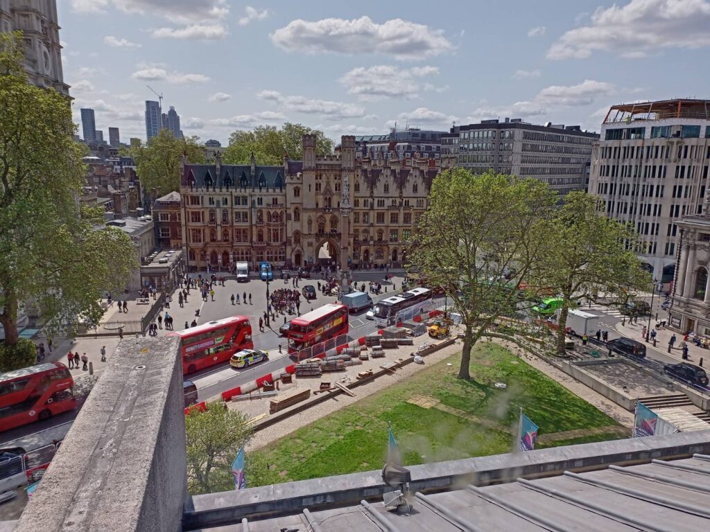
View from the Queen Elizabeth II Conference Centre, location of ESRI UK AC

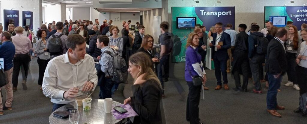
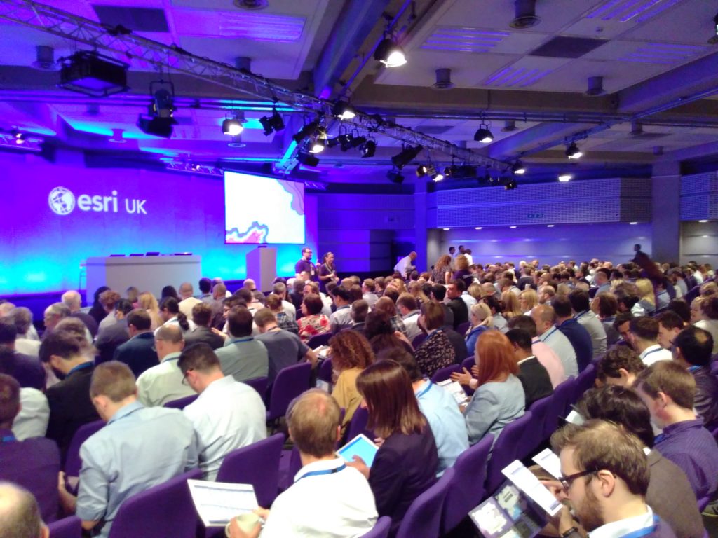
Along with many other people from the geospatial community, I was up in London earlier this week for ESRI UK Annual Conference, GeoBusiness and Spatial Data Science Conference. It was a great couple of days, and while I didn’t manage to attend everything (limited time, money and energy!) it was great to see and hear what I did.

ESRI UK’s Annual Conference had a couple fewer streams than usual, but it was still as busy. I also managed to get into one of the over subscribed training sessions, to see what had changed in ArcGIS Online recently. Digital twins were mentioned quite a bit, developing from my blog post about last year’s conference, and the vocabulary is evolving and the focus has now shifted to how they are actually useful.

Jurassic Fibre gave a great presentation about how their as-built survey validation process made use of in field tools to collect and verify data. They were comparing what was planned to be built against what was actually built, and had some great processes for managing this. It really shows not just how important data is, but also how important how linking different teams together is important to deliver a service.

Discussions and catching-up at ESRI UK annual conference

I also had some really useful discussions about sharing data between platforms – some people use ArcGIS, some use QGIS, some R, and so on. Everyone has good reasons for using the software they do, and it would be a hard struggle to get everyone (in a team, group or even organisation) to use the same software – and more often that not will be a waste of time. What can be done is to help everyone make use of the same data, and / or share data in exchangeable formats.

Accessibility also had a focus in the end keynote presentation, combined with ChatGPT. Large language models create great potential for interacting with maps and spatial data in a different way – a prototype demo showed how a user could verbally ask for information about a map, and the computer could give a verbal summary. No where near production yet, but it shows what could happen. There is a huge amount of potential here – with developing better interfaces for those suffering from visual impairment – or for better natural language interaction with maps. This linked a bit in with my PhD work, from 2008-2011, focusing on sonification, where I used sound to represent data in combination with vision. There are some videos and code demonstrating this (I’m sure the VBA code in ArcMap will no longer work, not the Google Maps API code, but the videos how how it worked!), as well as my PhD thesis itself.

Sonification – from a few years ago 😉

Will ChatGPT replace GIS Analysts? I don’t think so, so we will all still have jobs! It will certainly change what we can do, and some jobs will change. With any LLM, you need to know how to ask the right question as well as being able to understand the answer that comes back. Ultimately the skills will be in interpreting the results, and making a judgement call about whether it is useful or not. Google revolutionised the internet when it was launched – and LLMs will be no different. As ever, we always need to be critical of maps and spatial analysis output – and ChatGPT or Bard or any other LLM will not change that. If anything, it will make it more important!

“So don’t just use GIS, but use it critically.”

I also popped into the Spatial Data Science Conference party in Wednesday night, and it sounds like the conference was fantastic – next time perhaps!

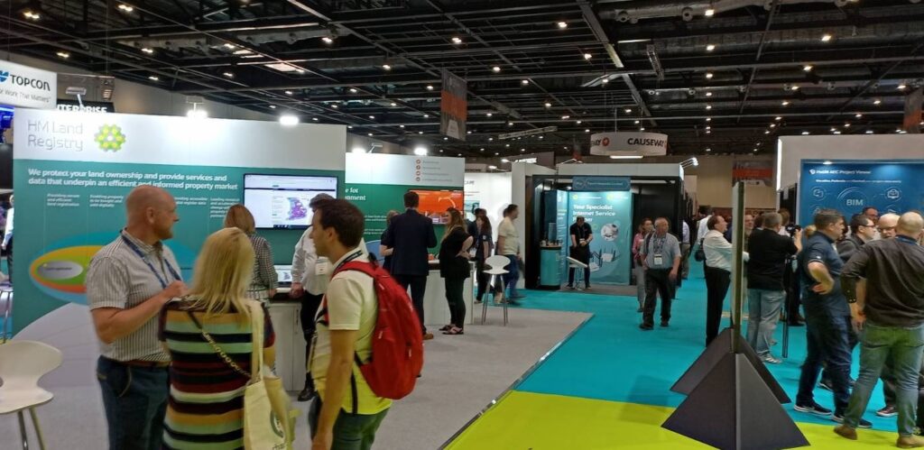
GeoBusiness followed ESRI AC UK, with a huge range of geo related businesses hosting stands and presenting talks. The stands were very equipment focused, with many new drones and surveying tool available to have a look at and discuss. However I was more interested in the talks and networking opportunities. The skills shortage was again raised as an issue, with not enough people available with geospatial skills. However speaking with those at the coal faces, new graduate with geospatial skills are being tempted away with starting salaries of £5k – £10k more for similar roles outside geospatial (e.g. programming) and even more for data science roles. It’s a hard ask for someone to give up £5k – £10k a year to stay in geospatial!

Developing skills of people coming into geospatial is something that is of particular interest to me, with a range of initiatives around training and skills development. While many users are big ESRI clients, there is certainly an increase in people wanting to use ESRI along side open source solutions – particularly QGIS. I see lots of potential for North Road’s SLYR tool, what they term: the ESRI to QGIS Compatibility Suite.

There are so many novel applications of GI data and one in particular caught my eye – ClearSky, a product from Aspia Space, have created a AI algorithm which converts uses cloud-penetrating Synthetic Aperture Radar (SAR) data to create cloudless multispectral imaging, right across the visible and short-wave infrared spectrum. This allows a ‘cloud-free’ view of satellite imagery – an interesting and valuable resource.

A different, but potentially equally useful application of GIS data was presented by Christopher Jackson from Advanced Infrastructure talking about geospatial tools for energy. They have created an application to help local councils estimate where it may be viable to install electric car charging points. The GIS analysis itself is not that ground breaking, as they are looking at a combination of IMD data, street width and electricity supply provision data to estimate feasibility and cost of electric car charging point installation – but the fact they think this is worth building into a product that can be sold is. It shows how vital geospatial data is and reminds me of the fact that there are still many people out there who don’t know what geospatial is. Communicating this is one thing we could all do better at.

It was great to see so many people, and chat about upcoming projects and opportunities, including FOSS4G:UK 2023 – watch this space(s) for more details soon: OSGeo:UK!

ESRI UK & GEO Business: Digital Twins or just Digital Offspring?

Last week I attended the first ESRI UK Annual Conference (17th May) and the first GEO Business conference (18th & 19th May) for three years (although GEO Business had a conference last autumn, which I didn’t manage to attend). It was great to be back at the Queen Elizabeth II Centre for the ESRI UK Annual Conference – it is always a great opportunity to meet colleagues working in GIS in the UK across all industries. Clearly open source didn’t feature that much (!) but all of the ESRI tools were showcased and it was a great opportunity to see what is coming up over the next year.

ESRI UK Annual Conference at QEII Centre, Westminster, London

Sustainability was the key theme of the conference, “GIS – Creating a Sustainable Future”, with the Met Office delivering the keynote focusing on climate change. I actually missed their presentation (a long train journey!) but hearing from other participants it sounded a good presentation, although there was the question of how we turn talk about climate change at the conference into action that makes a real difference in the world.

ESRI were very keen to push the ArcGIS Suite as a set of capabilities and focusing on what you can do with their tools, rather than the tools themselves. Highlights include new graph data structures now available in ArcGIS Pro, the versatility of LiDAR data and ArcGIS Image for ArcGIS Online, ESRI’s response to Google Earth Engine allowing processing of large satellite data in the cloud. On that note, ArcGIS Online was first launched ten years ago – which was a slight shock to many attendees! It has gone from strength to strength – and I do like how the ArcGIS products have made GIS more accessible to new users.

ArcGIS Hub also featured prominaty as a way of collating information and making it avaialbe to non-GIS users. We also heard about deep learning models being features in the Living Atlas, real time vechicle tracking (although interestingly no mention of ethics), and greater links with AutoDesk billed as ArcGIS GeoBIM. ESRI are also very keen on pushing greater use of the cloud – either provided through ESRI’s owns services, or, longer term, hosting the various ArcGIS products on the cloud yourself. We saw a great semo of ArcGIS Geoanalytics running a Python Notebook on databricks.

Finally, we had various mentions of ‘digital twins’. I remember the last GEO Business conference I went to in 2019 there was a lot of talk about digital twins, but nobody had actually created and used one. Now, a number of people have. One example was a model of buildings in London including information on how much water might be needed by the fire brigade to extinguish a blaze in a specific building and whether the water supply network could supply the needed amount of water. A few people weren’t convinced these were digital twins – as the key definition of a digital twin is that it includes real time updates. However, ‘real-time’ depends a bit on what temporal scale you are working to – and the amount of water needed to extinguish a blaze in a specific building probably wouldn’t change that much – so I think this is very case dependent.

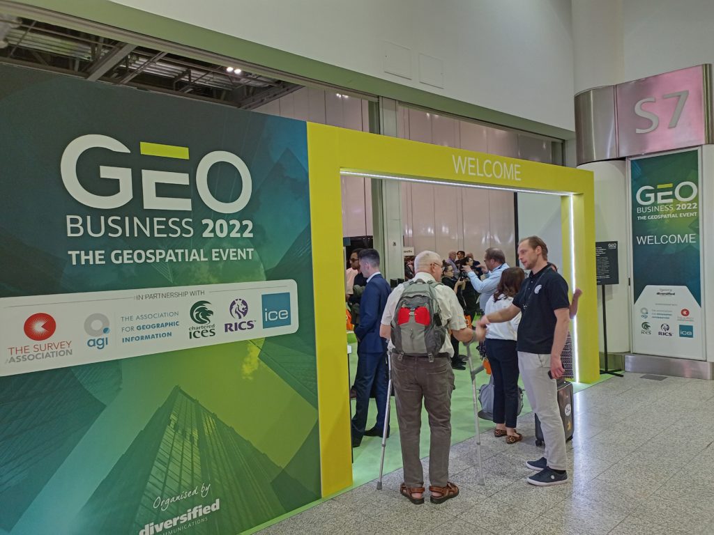
GEO Business 2022 at ExCeL, London

I also attended the GEO Business conference out at ExCeL on the following day. Again, this was a great networking opportunity, although with a slightly different subset of the geospatial community. I went to a couple of very interesting applications talks – including one from the Met Office by Anthony Veal, who was working on a pilot project to increase the rated capacity of overhead electricity lines depending on the weather. Currently, overhead lines are rated for their maximum capacity based on a worse case weather scenario, which is rarely reached. Heat is the main limiting factor on the lines, with wind being the primary mitigating factor. This project is working on moving from a static worst case scenario limit to dynamic limits based on the current wind conditions. It is still in relatively early stages, with one case study, but shows a potentially significant increase in capacity at certain times. This, arguably, could be considered a digital twin with its’ real time data but the Met Office didn’t use this term.

Doug Specht also gave an excellent talk on Teaching Geospatial Ethics, and how he approaches this with his audience of students who are not geographers, but are often asked to create maps. He summarised the issues as a very nice three principles:

  1. No visualisation is neutral
  2. Platforms have politics
  3. All perspectives are partial

This works very well for this students – journalists, writers and communication – and works as a great first step before looking at geospatial ethics frameworks like the Locus Charter.

Cloud processing also cropped up a lot at GEO Business, with many of the companies, large and small, offering new cloud based services for working with LiDAR point clouds, aerial photos and drones. There was also a nice expansion of engaging others with GIS and highlight how useful it can be across all professions – something I strongly believe in and see every day.

Overall it was a great couple of days, with lots to think about. Please do add your comments in below, and if you are interested in finding out how GIS could benefit your work, please check out my book GIS: Research Methods, the GIS courses I offer or reach out if you would like a chat.

Cross posted from https://www.geospatialtrainingsolutions.co.uk/esri-uk-geobusiness-digital-twins-or-just-digial-offspring/

Sunny London: Linked Data & ESRI

Earlier this week I have a very nice couple of sunny days in London attending a training course and a conference. It’s a nice change to attend a course (rather than delivering one!) and is also a great opportunity to add to my CPD log (particularly important for my Chartered Geographer status with RGS-IBG).

Some of my transport around London!

On the Monday I attended a half-day workshop on Linked Data, organised by Dr Claire Ellul at UCL and run by Bart De Lathouwer from the Open Geospatial Consortium. I’d come across the term linked data in various different situations, but hadn’t really done much with it, and this was a great opportunity to learn about it. The key bit about linked data is that it is solely formed from triples, sets of three, in the form “subject, predicate, object” such as “The pool – is – blue” or “student – name – value”. It also is a fundamentally different way of structuring data from a “traditional” relational database and so avoids many of the limitations, but also requires a completely different way of thinking about the data. This is quite a jump from what we are used to, and I think it will take a little while for linked data to properly take off. This is a good resource (http://www.opengeospatial.org/blog/1673) for some information on how OGC are working with Linked Data.

Queen Elizabeth II Centre, home for ESRI Annual Conference

On Tuesday it was ESRI UK’s Annual Conference, based at the Queen Elizabeth II Centre near Parliament. It was a great conference, with a massive range of examples of how ESRI’s various different products could be used. There were some great examples of using Strava data to help Jersey understand cycle route usage across the island; using this data to identify and remove bottlenecks in their infrastructure. We also had a presentation on how City Engine was used by Disney to help them develop the city behind the film Zootropolis (2016), allowing them flexibility to create and tweak a whole city design with limited time and resources.

A good turn out for the conference!

Unsurprisingly a significant chunk of content was on conversion from ArcMap to ArcGIS Pro, their new flagship product. There is a big focus around users having an identity and using this to both access local and remote resources for ArcGIS Pro (including, no doubt, an element of licensing). There was also a reasonably strong theme about pushing out GIS to non-GIS users, and making it easy to use for new-comers, particularly with the development of ArcGIS Pro which, for example, automatically includes a base map when you start a new project. Possibly not ground-breaking for regular users of GIS, but a big help to someone coming to GIS cold – now they have a map they can add their data to, rather than just a big blank space (when you start ArcMap).

If you would like a chat about getting more from your GIS (ESRI or other packages!), or GIS Training for small groups, please do email nick@geospatialtrainingsolutions.co.uk or give me a call on 01209 808910.

Cross-posted from http://www.geospatialtrainingsolutions.co.uk/sunny-london-linked-data-esri/.