Category Archives: conference

Sunny London: Linked Data & ESRI

Earlier this week I have a very nice couple of sunny days in London attending a training course and a conference. It’s a nice change to attend a course (rather than delivering one!) and is also a great opportunity to add to my CPD log (particularly important for my Chartered Geographer status with RGS-IBG).

Some of my transport around London!

On the Monday I attended a half-day workshop on Linked Data, organised by Dr Claire Ellul at UCL and run by Bart De Lathouwer from the Open Geospatial Consortium. I’d come across the term linked data in various different situations, but hadn’t really done much with it, and this was a great opportunity to learn about it. The key bit about linked data is that it is solely formed from triples, sets of three, in the form “subject, predicate, object” such as “The pool – is – blue” or “student – name – value”. It also is a fundamentally different way of structuring data from a “traditional” relational database and so avoids many of the limitations, but also requires a completely different way of thinking about the data. This is quite a jump from what we are used to, and I think it will take a little while for linked data to properly take off. This is a good resource (http://www.opengeospatial.org/blog/1673) for some information on how OGC are working with Linked Data.

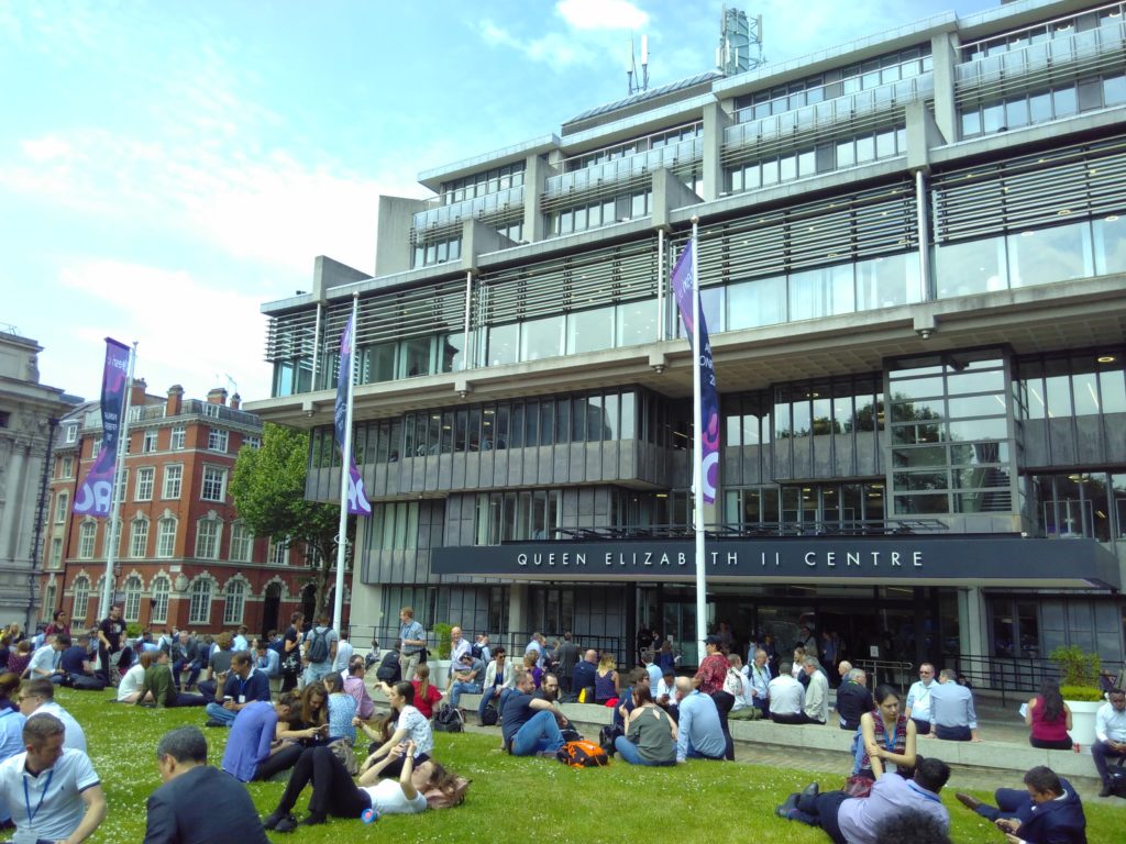
Queen Elizabeth II Centre, home for ESRI Annual Conference

On Tuesday it was ESRI UK’s Annual Conference, based at the Queen Elizabeth II Centre near Parliament. It was a great conference, with a massive range of examples of how ESRI’s various different products could be used. There were some great examples of using Strava data to help Jersey understand cycle route usage across the island; using this data to identify and remove bottlenecks in their infrastructure. We also had a presentation on how City Engine was used by Disney to help them develop the city behind the film Zootropolis (2016), allowing them flexibility to create and tweak a whole city design with limited time and resources.

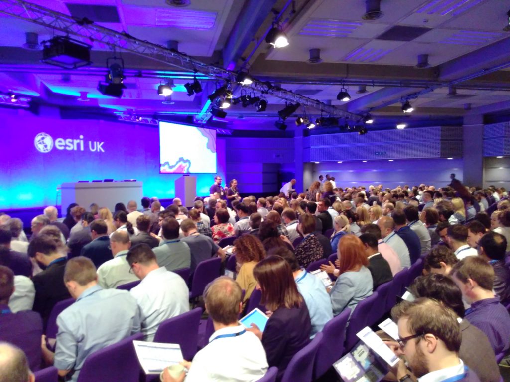
A good turn out for the conference!

Unsurprisingly a significant chunk of content was on conversion from ArcMap to ArcGIS Pro, their new flagship product. There is a big focus around users having an identity and using this to both access local and remote resources for ArcGIS Pro (including, no doubt, an element of licensing). There was also a reasonably strong theme about pushing out GIS to non-GIS users, and making it easy to use for new-comers, particularly with the development of ArcGIS Pro which, for example, automatically includes a base map when you start a new project. Possibly not ground-breaking for regular users of GIS, but a big help to someone coming to GIS cold – now they have a map they can add their data to, rather than just a big blank space (when you start ArcMap).

If you would like a chat about getting more from your GIS (ESRI or other packages!), or GIS Training for small groups, please do email nick@geospatialtrainingsolutions.co.uk or give me a call on 01209 808910.

Cross-posted from http://www.geospatialtrainingsolutions.co.uk/sunny-london-linked-data-esri/.

GISRUK 2018: A Return to Leicester

Last week I attended an amazingly sunny GISRUK (Geographic Information Science Research UK) conference in Leicester. I have fond memories of Leicester, as I completed my BSc Geography (2003-2006) and MSc GIS (2007 – 2008) there. Much of the university and city has changed, but an amazing amount is still the same – both in the Bennett building lecture theatres and certain well frequented take-aways!

University of Leicester – Attenborough Tower (L) and Charles Wilson Building (R)

I coordinated the Early Career workshops, where those early in their GIS careers (including, but not limited to, PhD and MSc students) came together for two half-day sessions to find out more about GIS as a career in academia and industry, to learn more and compare notes about their respective PhD/MSc experiences, and most importantly, to get to know each other before the main conference! We had a great variety of input from James Norris (Ordnance Survey / Group on Earth Observations / AGI), James Kendall (RGS), Dave Unwin (ex University of Leicester & Birkbeck), May Yuan (Editor-in-Cheif IJGIS, University of Texas at Dallas), Addy Popy (ESRI UK) and Katie Hall (ESRI UK).

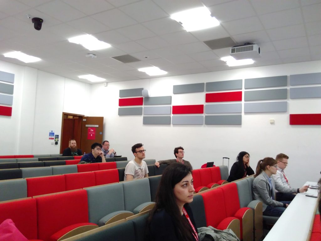
Early Careers session in full flow

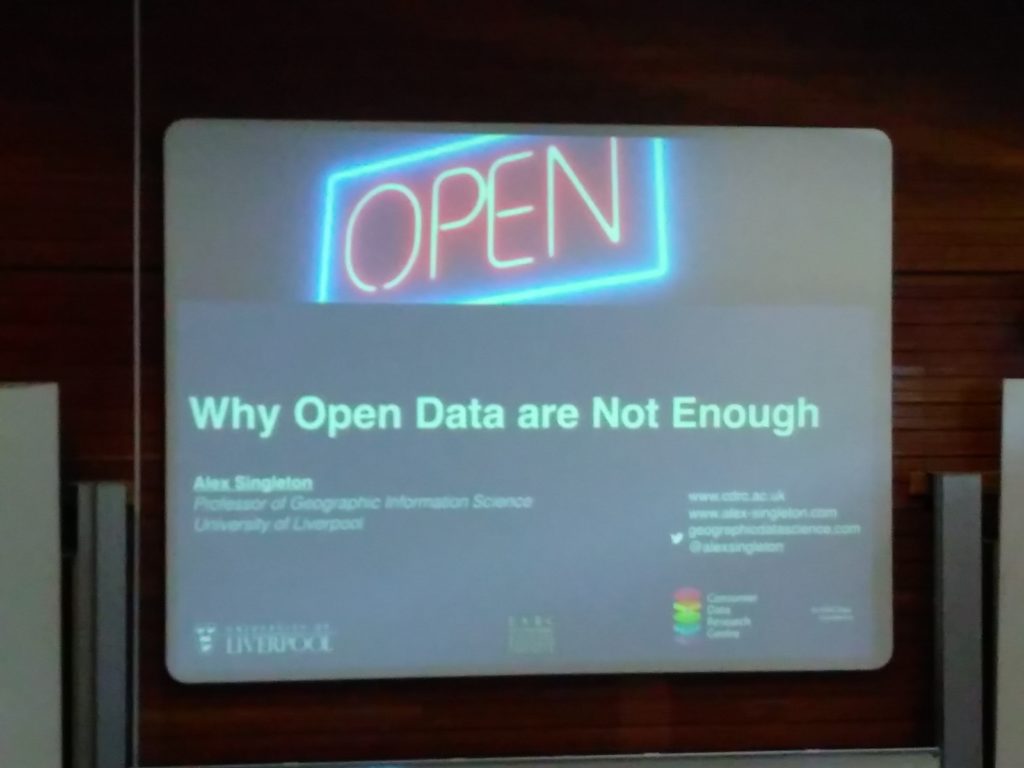
The main conference had a great selection of talks and presentations covering every application of GIS from archaeology, to crime, health, transport, and urban studies! It is always a challenge to work out which of the three parallel sessions to attend, and I can’t attend everything. Particularly of note for me was Alex Singleton’s keynote on ‘Why Open Data are Not Enough’, discussing some of the issues with open spatial data, particularly in terms of data longevity which very much reminds me of this XKCD comic, and still really hasn’t been solved for spatial data. This was rather well illustrated by the CDRC Data Store that has been developed through the Consumer Data Research Centre; there is no mechanism for ensuring this continues after the CDRC funding finishes, and this is the norm with many academic projects.

Alex Singleton: Why Open data are Not Enough

There was also a great presentation by Sam Cockings looking at how we can better model day time populations, from a variety of data sources. Integrating many real time data sources is going to be a key aspect of spatial data management in the future and I can see many projects using the skills and technologies Sam described.

Next year GISRUK 2019 will be in Newcastle University, and I look forward to seeing you there!

If you would like a chat about GIS Research, or GIS Training for small groups, please do email nick@geospatialtrainingsolutions.co.uk or give me a call on 01209 808910.

Cross-posted at http://www.geospatialtrainingsolutions.co.uk/gisruk-2018-a-return-to-leicester/.

FOSS4G UK 2018: A success!

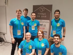
After 6 months or so of collaboration FOSS4G UK 2018 finally happened! I was a small part of the dedicated team who brought the conference together and it was an amazing experience. Thanks to James (@JamesLMilner), Tom (@tomchadwin), Isabel (@IsaUlitzsch), Sam (@SamRFranklin), Max (@GeospatialMax) and Dennis (@goldrydigital) as well as Jo Cook and Steve Feldman who gave us occasional nudges in the right direction with their experience from FOSS4GUK 2016 Southampton. Organising the conference felt a bit like organising a wedding(!) in that once we had picked the date, location, catering and sorted out the guest list, the rest more-or-less fell into place! Not that I intend to do either again in the near future!

FOSS4G UK 2018 Team Photo

Unfortunately I wasn’t around for the team photo on Friday, but I was there in spirit!

The conference itself went amazingly well and it was great to see so many people there who were so enthusiastic about open source geospatial software. Unfortunately I was only able to attend Thursday, but I managed to take part in some great workshops on pgRouting and Satellite Data, learn some new things, make some new contacts and baby sit the room-to-room live feed!

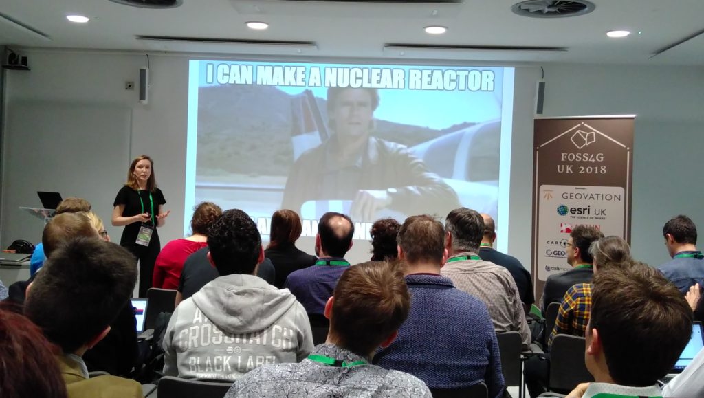
MacGyver putting in an appearance at FOSS4GUK 2018 in Mathilde Ørstavik’s Keynote talk on Extracting intelligent information from aerial images using machine learning.

It was a struggle to work out which stream to attend and I’ve seen from Twitter (#FOSS4GUK) that Tom Armitage went to town with the ‘May the FOSS be with you’ Star Wars theme, the highlight being a presentation using a light sabre rather than a laser pointer:


I still hope to have a run through of Tom’s workshop material when I get some time 🙂

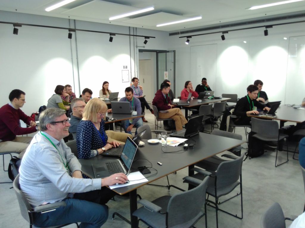
FOSS4G UK 2018 Workshop

Everyone hard at work in the pgRouting, PostGIS and QGIS workshop.

We will post links to all the slides and material we can on the website – if yours are not there yet, send them over or submit a PR. I do hope we can do this again, and if people would like to volunteer for the next conference, please make yourself known!

If you’d like a chat about potential for OS Geo training for individuals or groups, please do send me an email nick@nickbearman.me.uk or give me a call on 07717745715.

TEDx Truro – Beyond Barriers

On a sunny Friday at the end of half term, Nick attended the TEDx Truro event, ‘Beyond Barriers’ running at Truro and Penwith College. TEDx events are the ‘little brothers’ of the main TED events, the world famous series of short videos given in the area of Technology, Education and Design under the banner ‘Ideas worth spreading’.

TEDx events are independently organised and the Truro event is in its second year, with a sell-out crowd of 250 attendees. This years talks covered a really wide range of topics, covering everything from dyslexia, gender dysphoria, mental health, sex work, to biochemistry, depression, robots and artificial intelligence.

There was an amazing buzz in the auditorium, this continued during the breaks; there was idea sharing, discussions and even a selfie with some local celebrities! It was a great networking opportunity, meeting people from Software Cornwall, Pirate FM, Plymouth University and a whole host of local SMEs.

The talks around the area of mental health particularly resonated, with both Will Coleman (from Golden Tree Productions, famous for being the driving force behind The Man Engine) and Emma Wright (working for a national cancer charity in Cornwall) talking about how they had often presented one face to the world at large, but at times had another that truly reflected their feelings and experiences, which very few people saw. Many other speakers also discussed mental health in passing, and it is vital for mental health to be discussed more openly and easily than it is at the moment.

TEDx was organised by a great group of volunteers, so many thanks to them for organising everything and making it run smoothly. They are already planning for next year – head over to http://tedxtruro.com to find out what it’s all about, and we hope to see you there next year!

Cross-posted at http://www.clearmapping.co.uk/our-blog/item/492-tedx-truro-beyond-barriers.html

Catrograms

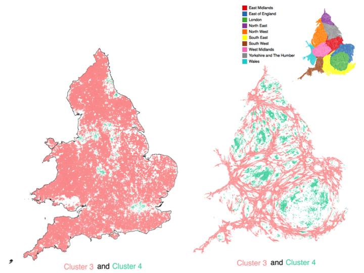
Cartograms are a great way of representing data that refers to people, and it allows you to give urban areas (which generally cover relative small areas) much more prominence than rural areas (which usually cover very large areas). The image below shows the usual geographic representation of the output areas, alongside the cartogram version. Note how the rural cluster (representing about 13% of the population) is very dominant in the ‘standard’ representation, but much less so in the cartogram representation.

Cartogram example

For my presentation at GISRUK2015 on TravelOAC (travel geodemographics) I was presenting a series of cluster data by 2011 Census output areas. Output areas are based around a standard population, with the result that many rural output areas are geographically large and many urban output areas are geographically small. When considering the classification data, it makes sense to give each output area equal consideration, so I decided to create a cartogram of the output area boundaries, based on the usual resident population.

I used a piece of software called ScapeToad which is a quick and easy way to create a cartogram from a custom data set. They have a good set of instructions on their website and the processing of all OAs in England and Wales (181,408 areas, 79mb shapefile) only took 49 seconds.

I was inspired by the cartograms used on the ONS Census Interactive website showing a range of variables. There are a number of ways of generating cartograms, and the ONS team used an approach based on http://lambert.nico.free.fr/tp/biblio/Dougeniketal1985.pdf where the browser does a lot of the heavy lifting. There is also an ArcScript available for ArcGIS at http://arcscripts.esri.com/details.asp?dbid=15638 which I used a few years ago and worked well then, but I’m not sure if it still does now!

P.S. Unfortunately I didn’t manage to see Chris’s presentation on cartogram methods (http://leeds.gisruk.org/abstracts/GISRUK2015_submission_83.pdf) as it was on at the same time as I was presenting!

GISRUK2015 and TravelOAC

I presented my work on TravelOAC at GISRUK this year, based at Leeds. The conference was great and it was a great opportunity to meet an incredible range of people involved in GIS, from engineers, historians, social scientists, spatial information scientists (as they like to be called!), mathematicians and, of course, geographers. We had a great crowd on Twitter as well (#GISRUK2015) who kept everyone up to date on proceedings, and I’d particularly like to mention @adjturner who has made his conference notes available online at . I was also involved in the GIS for Transport Applications workshop, which Robin has written up. Next year, we are at Greenwich, so see you there!

My slides and paper are available, and I have also written a post about how I created the cartograms I used in my work.

INLT Writing Retreat

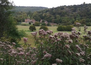
View of Juniper Hall from Box Hill

Last weekend I attended the INLT Writing Retreat, at the Juniper Hall Field Centre set in “an unspoilt area of the chalk North Downs”. The INLT (International Network for Learning and Teaching in Geography) is a group of geographers who want to improve the quality and status of learning and teaching of geography in higher education internationally, and every couple of years or so, get together for a writing retreat. 

I’d never been on a writing retreat before, and I really had no idea what to expect. In fact, I may not have even attended if it wasn’t for a HEA GEES workshop in Manchester on 23rd May where Helen Walkington plugged the INLT writing retreat workshop.

Once signed up, we did some work on our group topic (GIS Learning, spatial literacy and spatial citizenship) beforehand and laid out a few ideas. However it wasn’t until we were in the room together that the ideas for our JGHE paper started flowing. A mixture of writing group sessions and sessions with everyone enabled us to develop our ideas, get some very useful feedback, refine the ideas, collect some data, and do some data discussion all in a day and a half!

It was an amazing experience and I would recommend attending a writing retreat for anyone who wants to get their teeth into a discussion in their area, and get to meet some of the big names in their field.

Also posted on INLT website at: http://www.ucd.ie/t4cms/Collated%20reflections%20formatted.pdf.